Where Rupangarh sits
Rupangarh is the south-western end of our corridor — a fort town on the Naraina road where the belt meets the Kishangarh economy in Ajmer district. It is the only zone in the dossier outside Jaipur district on the agricultural side, and that changes where you look for records.
| Coordinates | ≈ 26.630° N, 74.860° E |
|---|---|
| Tehsil · district · division | Rupangarh / Kishangarh belt · Ajmer district · Ajmer division |
| Rail | Kishangarh is the nearest railhead, roughly 22–25 km (approx.) |
| Air | Kishangarh Airport (KQH) — the Ajmer-region airport, on the Kishangarh side |
| Road | Meets NH-48 on the Jaipur–Kishangarh–Ajmer axis. NHAI status documents dated March 2026 continued to list six-laning work on the Jaipur–Kishangarh section (km 273.500–363.885). Reported alignments of the proposed Kotputli–Kishangarh expressway pass the Rupangarh–Nawa region and terminate at the NH-48/NH-448 junction at Kishangarh; ₹4,938 crore in state loan funding for acquisition on this corridor was approved in May 2026 |
| Records | Apna Khata · Bhu-Naksha — district Ajmer, not Jaipur |
| Cost context | Ajmer-district DLC via e-Panjiyan |
Why the Kishangarh end matters
The strongest fact at this end of the belt is not a corridor announcement. It is an operating facility with an address. Adani Logistics Limited, the logistics arm of Adani Ports and SEZ, inaugurated a logistics park and inland container depot at Mandawariya village, Kishangarh — 100 acres in total with 35 developed in the first phase, about 4 km from the RIICO industrial area and 5 km from NH-8, with rail connectivity to Indian Railways and the Dedicated Freight Corridor. Per the company’s own announcement, September 2025. That is roughly 25–30 km from Rupangarh.इस छोर पर सबसे ठोस तथ्य कोई घोषणा नहीं, बल्कि एक चालू सुविधा है। अदाणी लॉजिस्टिक्स ने मंडावरिया गाँव, किशनगढ़ में लॉजिस्टिक्स पार्क और ICD शुरू किया (कंपनी की घोषणा, सितंबर 2025)। रूपनगढ़ से लगभग 25–30 किमी।
Rupangarh also sits beside a designated DMIC node. The Ajmer–Kishangarh Investment Region is one of Rajasthan’s five, alongside Khushkhera–Bhiwadi–Neemrana, Jaipur–Dausa, Rajsamand–Bhilwara and Pali–Marwar. That adjacency is the accurate corridor claim for this end — Phulera, at the other end, sits inside the influence region rather than in a node.
Kishangarh is not a place waiting for a project. It is an established marble processing and trading cluster with an existing freight profile, an airport and a position on the country’s busiest north–south highway axis. Beyond the operating depot, three corridor stories converge here — and each is at a different rung of the allotment ladder:
Three separate corridor stories converge on it:- NH-48 six-laning on the Jaipur–Kishangarh stretch — read the chainage, because "six-laning of NH-48" is a long project and a specific one.
- The proposed Kotputli–Kishangarh greenfield expressway, whose reported western terminus is the NH-48/NH-448 junction here.
- The proposed Jaipur–Pachpadra corridor, reported at roughly 350 km via Kishangarh, Ajmer and Jodhpur, reported as taken over by NHAI in 2025 with the DPR subject to revision.
Convergence is genuinely meaningful — but note the stages. One is under way, two are proposed. Land priced as though all three were built is priced on a scenario, not a road.
Semi-arid land — check the water
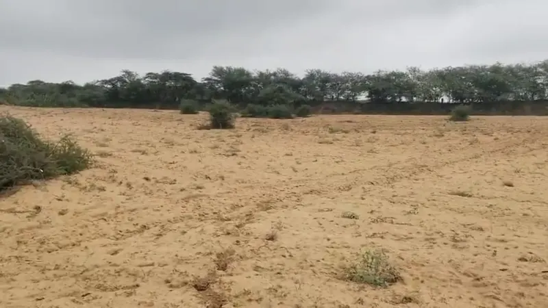
Sandy loam with Aravalli-fringe gravel toward the 17th-century fort, in a groundwater-stressed belt. Confirm the CGWB block category and test any bore for depth, yield and quality before you rely on it. Water is the constraint that decides what this land can actually do.
Acquisition exposure on this axis
Highway land acquisition begins with a notification under Section 3A of the National Highways Act, 1956, identifying the stretch by chainage, tehsil and district. Notifications on the Jaipur–Kishangarh–Ajmer–Jodhpur axis have been issued for specific stretches. If a khasra sits on an alignment, part of it may be acquired at a determined rate — which can be an acceptable outcome or a poor one, but should never be a surprise. Search for the notification covering the stretch before you pay.
Before you buy near Rupangarh
- Pull the jamabandi and Bhu-Naksha under Ajmer district.
- Check for any Section 3A notification touching the khasra.
- Test groundwater depth, yield and quality; confirm the block category.
- Read the girdawari, and the mutation chain.
- Confirm recorded access, and measure the drive to an actual highway entry point — not to the line on the map.
- Settle eligibility before committing.
Development near Rupangarh — what is confirmed रूपनगढ़ के पास विकास — क्या पुष्ट है
From our Belt Project Register. Each project sits on a five-rung ladder — announced, MoU, site identified, allotted, operating — because a project can be announced for years without a site. Nothing here is a price signal or a forecast. The whole register ›हर परियोजना पाँच सीढ़ियों में से एक पर है — घोषणा, MoU, स्थान, आवंटन, संचालन। यहाँ कोई क़ीमत या भविष्यवाणी नहीं है।
- Adani Logistics Park & Inland Container Depot, Kishangarh5 · In possession / operatingअदाणी लॉजिस्टिक्स पार्क एवं इनलैंड कंटेनर डिपो, किशनगढ़ · क़ब्ज़े में / संचालन में
Status: Operating — phase 1संचालन में — पहला चरण
Mandawariya village, Kishangarh. 100 acres in total with 35 acres developed in the first phase, about 4 km from the RIICO industrial area and 5 km from NH-8. Rail connectivity to Indian Railways and the Dedicated Freight Corridor. Serves retail, automotive, grain, bulk commodities and e-commerce. Roughly 25–30 km from Rupangarh.मंडावरिया गाँव, किशनगढ़। कुल 100 एकड़, पहले चरण में 35 एकड़ विकसित। RIICO औद्योगिक क्षेत्र से लगभग 4 किमी और NH-8 से 5 किमी। भारतीय रेल और डेडिकेटेड फ़्रेट कॉरिडोर से रेल संपर्क। रूपनगढ़ से लगभग 25–30 किमी।
Adani Ports & SEZ (APSEZ) announcement · September 2025 · last verified 2026-08-30
- CONCOR multi-modal logistics park, Kathuwas5 · In possession / operatingCONCOR मल्टी-मोडल लॉजिस्टिक्स पार्क, कठुवास · क़ब्ज़े में / संचालन में
Status: Operating — outside this beltसंचालन में — इस बेल्ट के बाहर
About 283 acres at Kathuwas, toward Alwar and Rewari. It is listed here because it is often pulled into belt conversations: there is no CONCOR asset in Phulera, Sambhar, Naraina, Dudu, Nawa or Rupangarh.कठुवास में लगभग 283 एकड़, अलवर–रेवाड़ी की ओर। यहाँ इसलिए दर्ज है क्योंकि इसे अक्सर बेल्ट की बातों में खींच लिया जाता है: फुलेरा, सांभर, नरायना, दूदू, नावाँ या रूपनगढ़ में CONCOR की कोई संपत्ति नहीं है।
CONCOR project disclosures · Location confirmed as at August 2026 · last verified 2026-08-30
- DMIC / NICDP — influence region, not a node5 · In possession / operatingDMIC / NICDP — प्रभाव क्षेत्र, नोड नहीं · क़ब्ज़े में / संचालन में
Status: Programme active — no belt nodeकार्यक्रम सक्रिय — बेल्ट में कोई नोड नहीं
The industrial programme built on the Western DFC spine, now under the National Industrial Corridor Development Programme. Over 58% of Rajasthan falls inside the DMIC influence area, which is precisely why the label gets attached to everything. Rajasthan has five designated nodes: Khushkhera–Bhiwadi–Neemrana, Jaipur–Dausa, Ajmer–Kishangarh, Rajsamand–Bhilwara and Pali–Marwar. The August 2024 CCEA approval of 12 new projects gave Rajasthan one node — Jodhpur–Pali. Nothing new for Jaipur or Ajmer. Phulera sits on the DFC spine inside the influence region and is adjacent to the Jaipur–Dausa node; Rupangarh is adjacent to Ajmer–Kishangarh. Neither is a node. Adjacency to a node is not node status.राजस्थान का 58% से अधिक हिस्सा DMIC प्रभाव क्षेत्र में आता है — इसीलिए यह लेबल हर जगह चिपका दिया जाता है। राज्य में पाँच निर्धारित नोड हैं। फुलेरा और रूपनगढ़ नोड नहीं हैं — नोड के पास होना नोड होना नहीं है।
NICDP / CCEA approvals; MoCI · CCEA approval August 2024 · last verified 2026-08-30
AgriZameen is an independent private platform, not a government body, and is not affiliated with any company named here. Check every item with its source before you rely on it.AgriZameen एक स्वतंत्र निजी प्लेटफ़ॉर्म है — किसी सरकारी विभाग या यहाँ नामित किसी कंपनी से संबद्ध नहीं।
Agricultural land for sale here right now
Every listing of agricultural land on sale is on the listings page.
See all agricultural land for sale →Looking to buy or invest in agricultural land in Rupangarh? Start with the record, not the price: read the jamabandi for the exact khasra on Apna Khata, match it to the Bhu-Naksha map, and check the land class and any mortgage or court entry. Every AgriZameen listing is declared by its seller, and AgriZameen promises no price and no return. See all agricultural land for sale · How to read the land papers · The buying checklist
रूपनगढ़ में कृषि भूमि (खेती की ज़मीन) खरीदनी है? हर लिस्टिंग विक्रेता द्वारा घोषित है — खरीदने से पहले जमाबंदी और भू-नक्शा ख़ुद देखें।
Buying here, the AgriZameen way
Gold only if the paper is clean. So we do three things, the same way every time — and we hand you the tools to check us.
देखे हुए दस्तावेज़Documents we've actually seen
Jamabandi, Bhunaksha and the mutation trail — listed on each parcel. No paper, no claim.
सीधा सौदाBuyer–seller direct
We inform; we don't sit between you and your record. No hidden layer, no inflated middle.
स्वतंत्र मंचIndependent — verify officially
Not a government body. Every record stays yours to confirm on the official portal before money moves.
Documents shown are for reference — always verify on the official record before any transaction.
Other zones: Phulera · Sambhar · Naraina · Bichun · Nawa · Shakun · Khatu Shyam Ji · View zone map
Reviewed August 2026. Corridor, alignment and notification status changes; no price, approval or timeline on this page is a commitment. Verify every record on the official portal and at the local Tehsil/Patwari office before any transaction. Nothing here is legal, tax or investment advice, and no return is assured.